


Photograph by Jesse McClary
Words by Liana DeMasi
photographs by allie + jesse
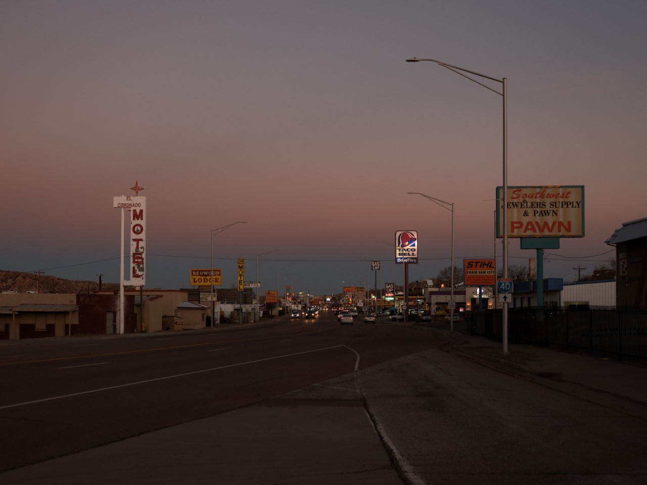
Glenrio has been a ghost town since the late 1980s. Straddling New Mexico and Texas along Route 66, the town used to operate under two state jurisdictions. The bars were on the New Mexico side as the Texan side was in a dry county. The gas stations were on the Texas side because the taxes were slightly cheaper. Glenrio was a tourist and traveler stop along Route 66 after the migration of the Dust Bowl Crisis died down in the late 1930s. The highway dwellers kept the town going with stops for gas, snacks, and a break to stretch their legs.
Then, in the late 1950s, construction began on I-40, and by 1975, Glenrio was effectively a ghost town, as the new highway bypassed their town altogether. Today, it serves as a tourist attraction along Route 66 for those who are seeking a nostalgia-latent adventure along the “Mother Road” or “Main Street of America”—nicknames that date back to the Great Depression. Their pictures and videos depict buildings in which a slow decay of stucco and cement give way to adobe infrastructures and left-behind artifacts.
All in all, there’s not much left in Glenrio nor is there much in any of the other abandoned and dilapidated towns and cities along Route 66. They instead find themselves on “Best Ghost Towns Along Route 66” lists, where road-trippers—likely clutching Kerouac’s On the Road or Steinbeck’s The Grapes of Wrath—stop along the way to catch a glimpse of quaint simplicity frozen in time.


Of course, there are more lively towns and stops along Route 66. One might find themselves at the Blue Swallow Motel, a Route 66 staple in Tucumcari, New Mexico, about 40 miles from Glenrio. Or one might venture into Albuquerque, Amarillo, Oklahoma City, or any other nearby bustling, inhabited city.
The Route 66 signage, road-stops, and souvenir shops are dedicated to a distant past, one that can be remembered through bumper stickers from each stop along the way. But what’s lost when we capitalize on nostalgia? We tend to cherry-pick anecdotes, stories, and memories that paint a more harmonious picture of the once-and-current world we’re driving through. We can presume this is what happened when John Steinbeck’s famous line from The Grapes of Wrath was severed in half. Many T-shirts, bumper stickers, keychains, and signs don half his line, “66 is the Mother Road.” In a succinct phrase, freedom and possibilities are encapsulated in the cross-country road-trip that is distinctly American. It’s the same ideology that inspired Kerouac’s On the Road, and movies like, Thelma and Louise, Bagdad Cafe, Cars, Easy Rider, and others. What’s out there? A Route 66 road-trip begs the question, but hidden in this query is how we came to possess “what’s out there.”


Manifest Destiny or the Great Expansion might come to mind. Or perhaps it’s the The Homestead Act of 1862, which allocated grants, mostly Western states of “federal land” to Americans, forcing Indigenous tribes off of their land. These inexperienced farmers overplowed the land for decades, eradicating native plants and the buffalo grasses that were safeguarding said land, and effectively causing the Dust Bowl Crisis of the 1930s. This led to millions of people packing up their wagons to move West towards California, using Route 66 and the trails that once comprised it as a migration route. So it makes sense that Steinbeck’s full line reads, “66 is the Mother Road, the road of flight,” and with our present and worsening climate crisis, we ought to consider the line—and its history—as a whole.
We tend to cherry-pick anecdotes, stories, and memories that paint a more harmonious picture of the once-and-current world we’re driving through.
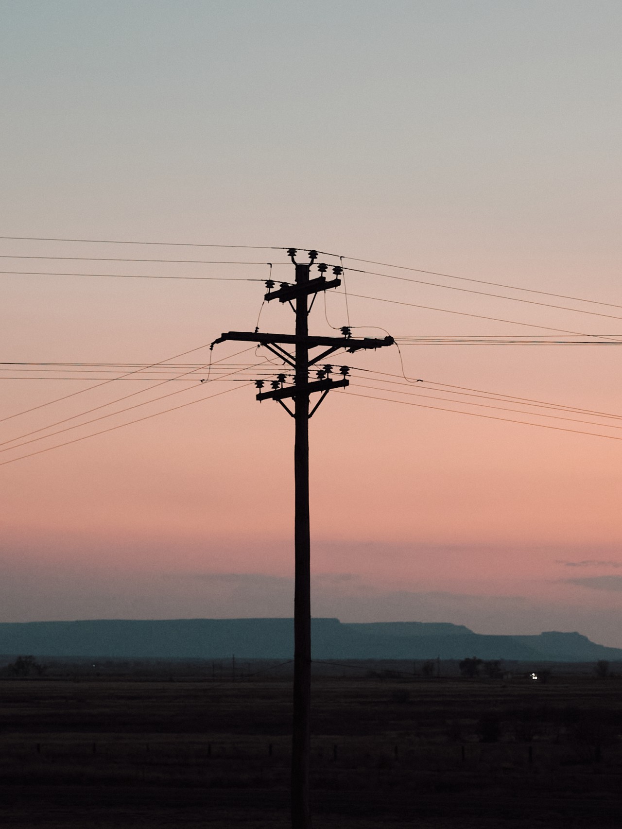
“We’re in a seven-year drought [in Oklahoma],” Jody Risley tells me. “It’s drier now than it ever was in the Dust Bowl.” Risley is the Director at Cimarron Heritage Center in Boise City, Oklahoma; the area was one of the hardest hit by the Dust Bowl Crisis, and the Center works as an encapsulation of that history. They have a genuine schoolhouse-turned-home from the original Dust Bowl as well as the tractors that broke the plains, causing the Crisis. It’s no surprise that Risley’s breadth of knowledge is as vast as it is. She comes from a long line of Oklahomans, which means that she was raised by people who didn’t leave during the Dust Bowl Crisis, and is tracking the very significant changes they’ve been experiencing since. “I have land on the edge of Colorado,” Risley continues. “My grandad homesteaded there in 1915. Back then, he drilled an 80 foot well, which went dry about six years ago. When we drilled another well, we had to go to the bottom of the canyon—was about 380 feet before we hit water. When I was young, we used to be able to dig with our hands and get water.”


But the climate is changing. Droughts are becoming more severe, water is receding, and the disasters that we face today are shifting our landscape, our chances of survival, and our habits and practices. The Institute for Economics and Peace predicts that by 2050, there will be 1.2 billion climate refugees. That—combined with a projected population of 9.8 billion by 2050 and no clear path to a regenerative and equitable future—is certain to eradicate even more resources. Risley expressed disappointment with the younger generation of farmers she knows, who are degrading and changing the irrigation systems that have been in place since the Dust Bowl to safeguard against another one. “They say, ‘When we run out of water here, we’ll just go somewhere else,’” Risley laments. “But where do they think they’re going to go?”
While the Heritage Center that Risley runs speaks to the climate migration inherent in Route 66’s history, most of that truth is lost in the route’s memorialization and its current fanfare. The same Indigenous Americans who were pushed off their land are stereotyped and appropriated as tourist attractions. Driving down Route 66, one can pass several sun-bleached billboards boasting “Traditional Indian Trading Posts,” ignoring the nuance and cultural diversity between tribes. One can also see the “World’s Largest Teepee,” which can be found in what is now called Arizona. Those Indigenous to that land, the Navajo people, traditionally resided in hogans. These colonizer-tourist traps offer a monolithic view of Indigenous Americans, and work to create a similar sterilized understanding of Route 66.


As we continue to capitalize on a narrowed nostalgia, we hurtle towards a future that will inevitably overlap with the past in the harms we have inflicted and are inflicting on the land. As Risley posited, where do they think they’re going to go? Where do we think we’re going to go?
The land of plenty that enticed migrants to California in the 1930s faces droughts, wildfires, and record-breaking flooding. We are facing and will continue to face detrimental shifts in our regional climates that will alter agriculture, our health, and our daily lives. Much more of America is destined to become ghost towns.
Much more of America is destined to become ghost towns.
Tesh Jennings Sakpal, a queer rancher in Tucumcari, New Mexico, has seen towns around him dissipate. “There used to be this small town nearby called Lesbia, but it’s not around anymore. People are leaving the agricultural communities because of a lack of opportunities,” Sakpal says. “Agriculture is dying. We don’t have water, so there’s nothing to grow.” Tesh tells me that while his land is set up for irrigation water, the levels have been so low that their systems haven’t been useful in the past three years. In an effort to grow food and safeguard the land, he’s been engaging in regenerative farming.
The hope is that, by investing in ecological practices, his house won’t be just another abandoned property along Route 66.


Join our membership community. Support our work, receive a complimentary subscription to Atmos Magazine, and more.
Route 66: The Mother Road’s Erasure of History and Nuance


